


Big Level Voting District, Stone County, Mississippi
About
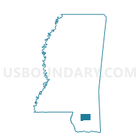
Outline

Summary
| Unique Area Identifier | 606684 |
| Name | Big Level Voting District |
| County | Stone County |
| State | Mississippi |
| Area (square miles) | 50.05 |
| Land Area (square miles) | 49.82 |
| Water Area (square miles) | 0.23 |
| % of Land Area | 99.53 |
| % of Water Area | 0.47 |
| Latitude of the Internal Point | 30.82806690 |
| Longtitude of the Internal Point | -89.02866370 |
Maps


Graphs
Select a template below for downloading or customizing gragh for Big Level Voting District, Stone County, Mississippi


Neighbors
Neighoring Voting District (by Name) Neighboring Voting District on the Map
- Flint Creek Voting District, Stone County, MS
- Janice Voting District, Perry County, MS
- Pleasant Hill Voting District, Stone County, MS
- Ten Mile Voting District, Stone County, MS
- Tuxachanie Voting District, Stone County, MS
Top 10 Neighboring County Subdivision (by Population) Neighboring County Subdivision on the Map
- District 4, Stone County, MS (4,099)
- District 5, Stone County, MS (3,739)
- District 5, Perry County, MS (2,443)
Top 10 Neighboring Unified School District (by Population) Neighboring Unified School District on the Map
Top 10 Neighboring State Legislative District Lower Chamber (by Population) Neighboring State Legislative District Lower Chamber on the Map
Top 10 Neighboring State Legislative District Upper Chamber (by Population) Neighboring State Legislative District Upper Chamber on the Map
- State Senate District 43, MS (62,195)
- State Senate District 47, MS (58,112)
- State Senate District 45, MS (57,871)